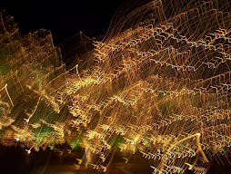
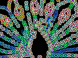
Courtesy The Daily Mail/UK. I'm not sure, though, what is defined as "major." I'm guessing magnitude 6. Impressive map:
If you are looking for somewhere safe from an earthquake, this might help.
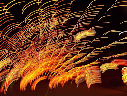
For this map shows the where every major quake has struck since 1898, and as you can see, the edge of the Pacific Ocean appears particularly dangerous. In total there are a staggering 203,186 of them, dotted all over the world.
The neon-coloured map was created as a side-project by mapping manager John Nelson, in a case of taking his work home with him, as he works for data-visualisation software maker IDV Solutions.
![]()
Go to the link. This map is bigger, and there's a bonus map of US tornadic activity over the last 61 years. It's like weather nerd catnip!
If you are looking for somewhere safe from an earthquake, this might help.
For this map shows the where every major quake has struck since 1898, and as you can see, the edge of the Pacific Ocean appears particularly dangerous. In total there are a staggering 203,186 of them, dotted all over the world.
The neon-coloured map was created as a side-project by mapping manager John Nelson, in a case of taking his work home with him, as he works for data-visualisation software maker IDV Solutions.

Go to the link. This map is bigger, and there's a bonus map of US tornadic activity over the last 61 years. It's like weather nerd catnip!


No comments:
Post a Comment