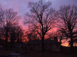
Spring 2011 extreme weather going nuts: Tornadoes off the charts, wildfires rage, floods loom
The bi-polar weather is a manifestation of an amped up jet stream, fueled by this spring’s moderate La Nina. Weather Nation meteorologist Paul Douglas told Discovery Magazine that jet stream winds are as strong as he can remember during April.
The jet, relentlessly surging south through the Midwest, has set up a volatile transition zone east of the Great Plains extending across the mid- South and Tennessee Valleys, occasionally reaching the Southeast. In this transition zone, where cold, dry air has persistently done battle with warm, moist air, seldom a day goes by without explosive, rotating thunderstorm development.
As discussed Tuesday, the U.S. is on pace for its most active tornado season on record, ahead of 2008. And next week, AccuWeather’s Henry Margusity predicts “an insane outbreak of severe weather”.
“Given the pattern next week, I can see 100-200 tornadoes over a four-day period starting Monday,” Margusity wrote.
No deaths in St. Louis tornado called a miracle
The St. Louis area’s most powerful tornado in 44 years rips into an airport and through a densely populated suburban area, destroying up to 100 homes, shattering hundreds of panes of glass at the main terminal and blowing a shuttle bus on top of a roof. Yet no one is killed, or even seriously hurt, and the airport reopens less than 24 hours later. How? (Their short answer? Jesus.)
..
The tornado peaked at an EF-4 level, second-highest on the Enhanced Fujita scale, packing winds of up to 200 mph, National Weather Service meteorologist Wes Browning said. It was the most powerful twister in metropolitan St. Louis since 1967 — and eerily, it followed a path similar to that of the earlier tornado.
..
Entire subdivisions were destroyed. Cars were tossed about like toys, roofs tossed hundreds of yards and 100-year-old trees sucked out by the roots. Gov. Jay Nixon said 750 St. Louis-area homes were damaged, with up to 100 of them uninhabitable. The damage clearly will cost millions of dollars to repair, but a more precise estimate was unavailable Sunday.
April rain more than double the norm (HENDERSON, Ky.)
With nearly a week left in April, we've already received more than double the normal amount of rainfall for the month -- and more is in the forecast.
As of 7 a.m. Sunday, a Center Street rain gauge had recorded 10.02 inches of rain this month. That included 5.78 inches in just the previous five days, and 4.06 inches in 48 hours.
On average, the entire month of April brings 4.52 inches of rain here, based on 30 years of weather observations reported by official observer Cardinal Farms just south of Henderson.
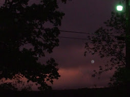
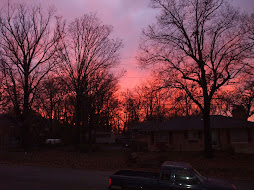
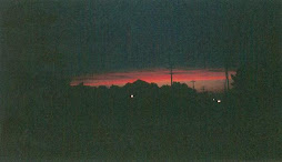
A very bad week ahead From The Weather Channel.
At the moment and for the moment, the rain has stopped. It will resume shortly, and the worst, according to forecasts, is yet to come tomorrow. The system's severity is notable, but the real soul crushing aspect (so far) is monotony, the dull repetition of an unwanted guest who continues to return, who refuses to leave, long after its necessity or usefulness has..
Don't go away mad, Rain: Just.. Go Away.
The bi-polar weather is a manifestation of an amped up jet stream, fueled by this spring’s moderate La Nina. Weather Nation meteorologist Paul Douglas told Discovery Magazine that jet stream winds are as strong as he can remember during April.
The jet, relentlessly surging south through the Midwest, has set up a volatile transition zone east of the Great Plains extending across the mid- South and Tennessee Valleys, occasionally reaching the Southeast. In this transition zone, where cold, dry air has persistently done battle with warm, moist air, seldom a day goes by without explosive, rotating thunderstorm development.
As discussed Tuesday, the U.S. is on pace for its most active tornado season on record, ahead of 2008. And next week, AccuWeather’s Henry Margusity predicts “an insane outbreak of severe weather”.
“Given the pattern next week, I can see 100-200 tornadoes over a four-day period starting Monday,” Margusity wrote.
No deaths in St. Louis tornado called a miracle
The St. Louis area’s most powerful tornado in 44 years rips into an airport and through a densely populated suburban area, destroying up to 100 homes, shattering hundreds of panes of glass at the main terminal and blowing a shuttle bus on top of a roof. Yet no one is killed, or even seriously hurt, and the airport reopens less than 24 hours later. How? (Their short answer? Jesus.)
..
The tornado peaked at an EF-4 level, second-highest on the Enhanced Fujita scale, packing winds of up to 200 mph, National Weather Service meteorologist Wes Browning said. It was the most powerful twister in metropolitan St. Louis since 1967 — and eerily, it followed a path similar to that of the earlier tornado.
..
Entire subdivisions were destroyed. Cars were tossed about like toys, roofs tossed hundreds of yards and 100-year-old trees sucked out by the roots. Gov. Jay Nixon said 750 St. Louis-area homes were damaged, with up to 100 of them uninhabitable. The damage clearly will cost millions of dollars to repair, but a more precise estimate was unavailable Sunday.
April rain more than double the norm (HENDERSON, Ky.)
With nearly a week left in April, we've already received more than double the normal amount of rainfall for the month -- and more is in the forecast.
As of 7 a.m. Sunday, a Center Street rain gauge had recorded 10.02 inches of rain this month. That included 5.78 inches in just the previous five days, and 4.06 inches in 48 hours.
On average, the entire month of April brings 4.52 inches of rain here, based on 30 years of weather observations reported by official observer Cardinal Farms just south of Henderson.
A very bad week ahead From The Weather Channel.
At the moment and for the moment, the rain has stopped. It will resume shortly, and the worst, according to forecasts, is yet to come tomorrow. The system's severity is notable, but the real soul crushing aspect (so far) is monotony, the dull repetition of an unwanted guest who continues to return, who refuses to leave, long after its necessity or usefulness has..
Don't go away mad, Rain: Just.. Go Away.


No comments:
Post a Comment